Richmond to Monash University, and home again. Here are some of the hi-lights and low-lights of my daily ride to and from work.
Despite a personal dislike for “cycle paths” and most other cycle-specific infrastructure, most of my commute does use one of Melbourne’s bike paths… except that they aren’t really bike paths.
Every off-road bicycle path in Melbourne is really a shared-use pedestrian footway, where pedestrians have absolute right of way over cyclists, and there is no legal enforcement of the keep left requirement, or any of the other rules and regulations, which appear to be little more than local council suggestions. So as a result you’ve got cyclists on the left side, overtaking on the right, but pedestrians might be walking on the left side, or the right side or straight down the middle, and they might move to the left, or the right, stand still, or just abuse you if they hear you coming.
So why do I use the Gardiners creek path? Mostly because it is the quickest and most direct route. It would be even quicker if the designers of the path hadn’t been besotted with bridges, and made the path cross back and forth over the creek at every opportunity. On the plus side, there’s a wealth of wildlife to be seen — mostly birds — and its generally much quieter than the road.
The majority of commuters are those that live in the suburbs and work in the city, so each day I pass a fairly constant group of riders heading in the opposite direction. Sometimes we nod to each other, but I’ve no idea who any of them are. Every couple of weeks a friend of mine hurtles past in a blur heading home — we’ve never quite collided head on, but there’s been a few close calls!
Leaving home, an illegal short-cut across 50m of footpath between Park street and Yarra Boulevard, then right along Yarra Boulevard, ignoring the narrow, winding, bumpy and unmaintained Yarra bike path. Minor hazards to avoid here are the speeding motorists, and the rapidly opening doors from those who use the road as their daily car-park.

The amazing, and expensive, suspended bicycle path along Gardiners creek under the Monash freeway
After following Yarra Boulevard to where the Gardiners creek path joins the Yarra path, there’s a tight left-hand turn and climb up onto the cycle-path bridge, then along one of Melbourne’s cycle path engineering marvels — the suspended cycle path. Rather than build the track alongside the creek, millions of dollars were spent on constructing a suspended track that hangs down underneath the Monash freeway. Why do this rather than along the public land next to the creek? There is a private school bordering the public land, I’ve been told that they pressured the government into disallowing the cycle track next to their property…
Under Glenferrie road, a commonly flooded underpass, then up and around the badly-cambered spiral ramp, over the creek and a right turn to follow the cycle track across the sports oval. This section of the track is used by a large number of students from Melbourne University’s Hawthorn campus, and from their , the majority of them are incapable of reading the English-language signs stating “Keep Left.”
Castle Greyskull (Otherwise known as the Coles Myer Head office)
Leaving the students, I continue on around past the velodrome, then follow the track along the creek, under Toorak road, the most common site of , then follow the path all the way to East Malvern train station, first through the wasteland near the Coles Myer head office, then the parks and reserves of Glen Iris. Two major and one minor roads to go under, Burke road, High street, and Great Valley parade, the latter two both having steep windy ramps to get down to creek level and under the roadway.

Looking west along Gardiners creek from one of the myriad of bridges on the cycle path
The last kilometre or so of this is around the public golf course, thankfully separated by a 3m high chain-mesh fence, designed to protect the general public from random golf-balls. Unfortunately, the users of the golf course have chosen to cut large holes in the fence to expedite crossing from one green to another, and the occasional stray ball hurtles through, along with golfers who step out in front of cyclists.
Across the foot-bridge over the Monash freeway, glancing down to read the amusing “Slow Down” painted on the way up the steepest part of the bridge, then follow the track around to the left. I try to remember to hold my breath while crossing the first park, since there’s been a sewage leak there for as long as I can remember. Then continue along behind the houses to the crossing over Waverley road.

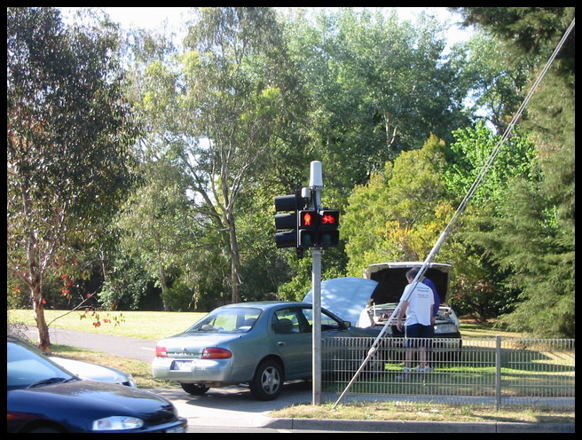
Car blocking the bike track
The pedestrian crossing at Waverley road is a good place to catch my breath, since there’s usually a delay of almost a minute between pushing the button and the lights starting to change… then there’s the 15 seconds while I watch for motorists driving through the orange and then red lights, before finally I can continue on my way!
The path continues through the narrow park between the freeway sound-abatement fence and the back of the houses towards Warrigal road, here I’m within half a suburb of the Chadstone shopping centre, so the likelihood of meeting abandoned shopping trolleys is high. It also seems to be some sort of epicentre for migratory plastic bags — every bush is festooned with them.
Up and over Warrigal road, then along back streets to the crossing with Atkinson street in Oakleigh — why bother going up and down kerbs onto the bike track when there’s perfectly good quiet streets to use? Back onto the track for the block or so to the Oakleigh Recreation Centre, then back onto the roads to wend my way around the car yards and tyre vendors’ premises to get to Ferntree Gully road. Anything and everything goes here, there are cars facing both ways parked on both sides of the street and I might meet anything from a fork-lift to a semi-trailer, but it still seems easier than attempting to use the track that crosses all their driveways!
Now for my daily hill-climb training. Ferntree Gully road heads straight up to a crossing with Huntingdale road, a pause at the lights, then coast down and a second climb up to Clayton road. There’s usually no problems with traffic, other than the noise, the only excitement comes at the right-hand turn into Clayton road. Depending on the phase of the lights, traffic, and personal whim, I’ll either cross the three lanes to the right-turn lane, or perform a hook turn from the left.
Clayton road can be a intimidating. A widely ignored 60km/hr speed limit, two narrow lanes in each direction, and a lot of passing traffic doesn’t particularly recommend it, the alternative is to continue along to the lightly-trafficed Gardiners road, which has a 50km/hr speed limit, one wide lane, and use the cycle lane along the left. Unfortunately, or typically, the cycle lane ends half a block from the intersection with Bayview avenue, and traffic turning into the University squeezes cyclists off the road well before the corner. Riding down Clayton road to turn left into Bayview gives a clear run straight to the University gate.
Last noteworthy obstacle of the day is the large roundabout inside the gate. A right-hand turn around this can be accomplished with varying degrees of ease depending on the number, and skill-level, of the students and staff attempting to overtake me, and on the one or two each year who manage to drive the wrong way up the one way roads.
Returning home is almost the reverse of the morning ride, with a few exceptions. Leaving the University I head up the cycle lane in Gardiner road to turn left into Ferntree Gully road. I usually cut the left turn out by detouring through the Bunnings car park, since there’s a squeeze point at the traffic lights, where naturally the cycle lane disappears. The cycle lane is also a clearway, so there shouldn’t be anyone parked in it, but it also goes past a pub, so there usually are cars parked in it.

The brick-making equipment in Brick Maker's park
Along Ferntree Gully road almost to the junction with Dandenong road, this is the fastest section of the day’s riding, I think I’ve hit around 65km/hr down one section. A right turn into a side road, then an illegal shortcut along the paths through Brickmaker’s park — at least I think its illegal, there are so many bits of path and track around there that I’m not sure what is bike path and what is footpath. The two hi-lights of the park are the old brick-making equipment, and the stream through the centre — it’s been turned into a kids’ activity centre with water-wheels and movable gates, definitely worth investigating!
From the western end of the park, its back along the Gardiners creek track as far as the crossing of Waverley road, then I usually turn left and use the road as far as High street. It seems to take the same amount of time whether I use the bike track and have to ride slowly and zig-zag over the creek, or use Waverley, and then Malvern, roads at a faster pace, but stopping for the traffic lights. Where these roads are wide there’s a bicycle lane, naturally this disappears at every intersection or where the road becomes congested — I really don’t know why they bother!
The turn from Malvern road into High street is always exciting, with motorists following each other lemming-like through orange and red lights, then invariably being stopped at the traffic light combination of pedestrian crossing, railway crossing, and freeway crossing. Once I’ve made it through this, a quick left turn into Hope’s Rise and I rejoin the Gardiners creek bike track for the remainder of the way home.
Cruising around Yarra Boulevard in the evenings is generally pleasant, its a common training ride for some, a recreational ride for others. At the Swan street bridge I often find rock-climbers practicing on the blue-stone boulders that make up the wall — inching their way the length of the underpass, 30cm off the ground.
The last detour that I sometimes make on the way home is to continue for the length of Yarra Boulevard, turning left into Bridge road to stop for an hour at the first corner. Why? The Bridge Hotel is at the end of my street, its a fine place for a beer on a sunny evening!
Hazards

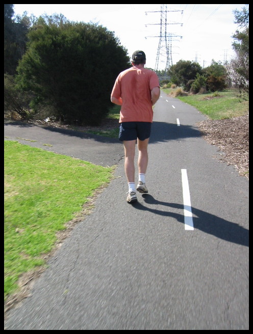
Shared path, jogger ahead
Of course no ride is perfect, mine includes a number of hazards. The most prevalent are pedestrians, with or without dogs, walking, jogging or running, on the left, on the right, or along the centre… The jogger pictured is one of about 40% who keep left, as is legally required, I’m usually too busy swearing, cursing, and swerving to get a photo of the rest of them.
I’m always wary of the local council requirement to “audibly warn pedestrians of my approach” — too many times I’ve found that people behave in a completely random manner, and are just as likely to leap from the left of the path across to the right-hand side as they are to keep left. There’s also a percentage who just don’t care and ignore cyclists anyway, and a smaller percentage who go out of their way to force riders off the path!
Dog owners seem especially self-righteous, it is far more common to see dogs roaming around while the owner casually waves an unused lead, than to see the dogs on the lead — regardless of whether the council signs say its an Off-lead area or not. And the “Clean Up After Your Dog” signs seem to always apply to other people’s dogs — yet another unsavoury hazard on the paths.

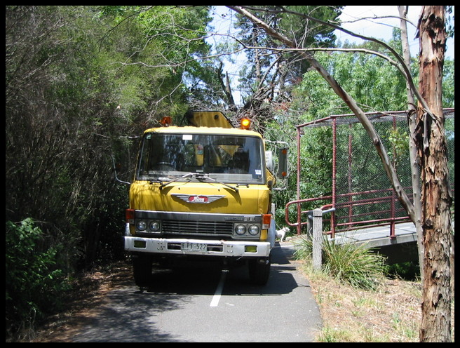
Bike path hazard
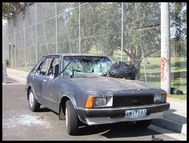
Less frequent than the pedestrians are the vehicles, council workers who think nothing of driving trucks at 30km/hr along narrow cycle tracks, or parking to completely block the path, motorists who use the bike tracks to park broken-down vehicles, the odd abandoned car, and the occasional motor-cyclist using the bike track as a short-cut between roads.

Abandoned car I pass every day
On the roads there’s always the motorists with the mobile phone, or the ones that must overtake and then turn sharply left. Other cyclists are hazardous at times, the main problems I find are at night in the winter on the unlit paths, some have lights so badly adjusted that they dazzle, some have no lights at all, and some have a red-flashing light on the front of their bike! This last lot are scary, with no other light around I think that they are heading in the same direction I am, only slower. Trying to “overtake” results in a near miss and much swearing!
Environmental hazards come last, the design decision to stick a bike track along what is basically a storm-water drain means that parts of the track become impassable after the slightest rain. Lack of drainage and lack of maintenance add to the excitement of using the track — there’s always an overhanging branch or encroaching bush to duck around, or cracks, potholes and large pools of standing water to avoid.
Wildlife
One advantage of a ride along the creek and through parkland is seeing the multitude of wildlife, even in the city and suburbs. I’m sure if I stopped for a while I’d see even more. Without including the pet dogs and cats, I think I can remember seeing:
Fish: European Carp, Short-finned Eel
Reptile: Eastern Long-necked tortoise, skinks, Red-bellied Black snake
Bird: Crested Pigeon, Common Bronzewing, Spotted Turtle-Dove, Red-rump Grass Parrot, King Parrot, Eastern Rosella, Rainbow Lorikeet, Sulfer-crested Cockatoo, Galah, Yello-Tailed Black Cockatoo, Gang-Gang Cockatoo, Cockatiel — probably an aviary escapee, Pied Mudlark, Magpie, Australian Raven, Laughing Kookaburra, Superb Fairy-wren, Pacific Black Duck, Australian Wood Duck, Australian Shelduck, White-faced heron, Nankeen Night heron, Australian White Ibis, Great Egret, Little Pied Cormorant, Eurasian Coot, Dusky Moorhen, Masked Lapwing, Willy Wagtail, Noisy Miner, Bell Miner, Silver Gull, Australasian Grebe, Little Pied Cormorant, Welcome Swallow, Pied Currawang
Mammal: Water rat (rakali), mice, Brush-tail possum, Ring-tailed possum
Pest: Sparrow, Blackbird, Common Myna, Mallard, Pigeon, Geese, Goldfinch

