Second day of our four day ride along the Otago Central Rail Trail
Omakau to Wedderburn with a mix of weather, overall a bit less windy than although we did get caught in a rainstorm in our last half hour to Wedderburn.

Otago Central Rail Trail - day 2 - Omakau to Wedderburn
Breakfast and packed in time for our bag to be collected for transport, then onto the bikes and around the corner to the She Bikes, He Bikes shop to get Jo’s handlebars adjusted – yesterday we’d got height and brake levers correct, but the assymetric “hand-shaped” grips were at an odd angle putting a large lump in her palms and as luck had it, they were held on by the one Allen key that I didn’t have with me.
Back up to the trail and off in the morning sun with an early coffee stop an hour later at Lauder.

Nothing particularly memorable about the coffee, although the weather did change from warm and sunny to cold, wet and windy while we sat on the verandah and the showers from the south-west caught us up. The coffee did get its , being my last ditch attempt to get my seventh coffeeneuring “ride an a coffee” in seven weeks.
More gorge country and tunnels – perhaps after lunch, now I’m confused, writing this up a few weeks later and unable to make sense of my scrawly journal notes1. A first for all of us as we saw a stoat early in the day, running along the track in front of us before diving off into the bush. Plovers and chicks, ducks, lots of English finches – goldfinch and chaffinch mostly – and skylarks, Swamp harriers and a New Zealand falcon perched up high on the rocks above Tunnel number 13. Although it was my third time in New Zealand, I think it was today that it really started to hit home just how many introduced species there are. I think the tui and shelduck were the only noticeably different native birds that I saw in the entire week – everything else was either introduced or common to New Zealand and Australia.

We ignored the signs telling us to dismount and walk through the two tunnels, lights on and proceed slowly, there was no other traffic around and no trouble riding through.
Lunch stop was the Otureha pub and a very tasty, if messy, egg and bacon roll then back out for the 7km climb to the highest point on the trail. Only just out of town and we caught the edge of a hailstorm, big soft, wet hail that landed with a ‘splot’ and although slushy icy cold, didn’t sting like hail normally does. By the time we’d stopped, grabbed out the rain coats and put them on it had passed over us and gone.
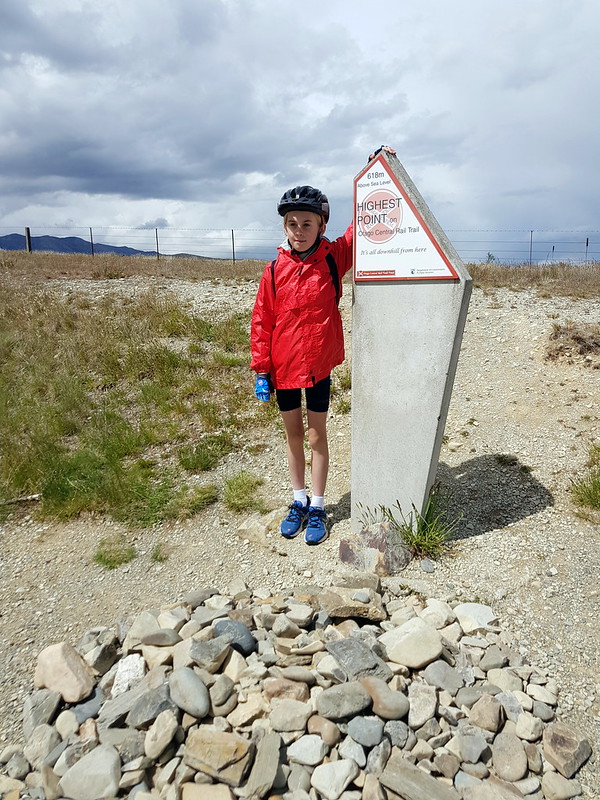
Past the first of two 45°S monuments before the climb, then up at the top the other 45°S monument and then the “Highest Point” monument (618m ASL). We could see rain around in the distance, unsure which direction the various clouds and front where heading. We stopped at the highest point marker and hunted around for geocache GC3GRVT – I’d checked for any nearby while at the pub when we had wifi. No success at all as the three of us searched – then I checked the details on my phone, I’d been going from memory expecting the app. to not show anything with no mobile data available. Found I’d misread the description and we were at the wrong monument, the geocache was a couple of hundred metres back down the track at the 45°S monument! With the rain approaching Jo and I were in favour of making for Wedderburn but we were overruled by number one son, so back down the hill for a quick – and successful – search and logging of our first international geocache.

2019-11-20T15.05.00.0570_samsung
618m above sea level, highest point on the Otago Central Rail Trail
Of course the delay was our undoing, starting back up to the top and over towards Wedderburn we were caught by icy wind and rain for the last stretch down the hill to our accommodation for the night. Warm shower and a large mug of tea restored us, followed by a lazy hour or so in the lodge and a walk down the hill for another large pub meal, this one at the Wedderburn Tavern.
Footnotes
1 Aha. Checking up against my photos it was before lunch.


