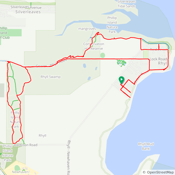
17.98km / 1:35:08 / 210m / 13.4°C
An afternoon exploration of the RAMSAR wetlands to the north of Rhyll… and some of the streets of Rhyll to get there. Google maps shows a road along the side of the bay, but each of the roads we went down ended in a dead-end or a muddy footpath to the waters edge so we’ll just chalk that down to another Google map road that never existed. Up past the boat ramp and sailing club to the wetlands, then follow the boardwalk all around the coast, cursing that we’d left both binoculars & bird book in the house! A shower of rain as we got to Conservation hill had us hurriedly retrace our route 100m to a shelter to wait it out, then onwards for a lap of the Oswin Roberts Reserve before taking the shortest route home straight along the Cowes-Rhyll road.
Light rain, 18°C, Feels like 12°C, Humidity 74%, Wind 10m/s from W - by Klimat.app
Riding 477th day in a row, including my ;
Garmin | Strava | ridewithgps


