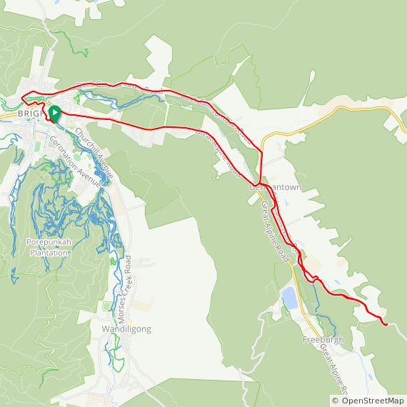
22.51km / 1:07:34 / 132m / 28.6°C
Out for a later afternoon ride, the storm clouds building. Decided to try the “Back Germantown road” and follow it to wherever it goes. Earlier today google maps had indicated that the route to Mount Hotham went this way… but I don’t believe it.
Started as a sealed country lane, then dirt, then narrower dirt and climbed off into the hills… after about 10km I decided that it was late in the day, I was heading for a very large very black thunderstorm, and I had no idea where the road really went, so I turned around and headed back to Bright. Took the road along the north side of the river and had to ford a knee deep creek, then time trial it back to town ahead of the summer thunderstorm. All up an interesting ride
Broken clouds, 33°C, Feels like 33°C, Humidity 40%, Wind 1m/s from ENE - by Klimat.app
Riding 762nd day in a row, including my and astoundingly, all of 2021.
Garmin / Strava / ridewithgps


