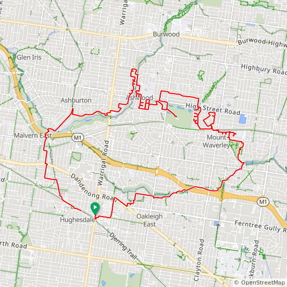
30.26 ㎞ / 1:59:23 / 390m / 21.0°C
A lazy loop around; out to Mount Waverley and wiggle about through streets that wandrer says I’ve not yet ridden. There’s another colouring-in competition too, I found the squadrats webpage and linked it here as well. Fun and games as both seem to use the OpenStreetMap data for their roads, and some of the private roads, eg golf courses, are listed as public. Some of the laneways which are legally “roads” are listed as footpaths, so they don’t show up. Room for improvement, but I’ve had no success convincing OpenStreetMap that a laneway is a road not a footpath
Broken clouds, 16°C, Feels like 15°C, Humidity 45%, Wind 7m/s from SSW - by Klimat
Garmin / Strava / ridewithgps
