A clearer day today, still not picture-postcard weather, but more conducive to tourism than ! Over a home-cooked breakfast of bacon and corn-fritters we examined the maps, and decided to head to the northern reaches of the Grampians, possibly re-visiting some of the lookouts if the weather was clear.
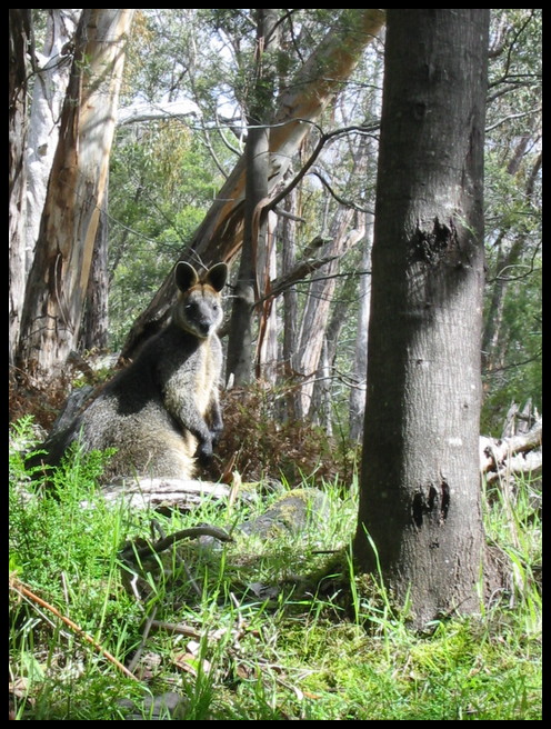
First stop after leaving Pomonal was the tunnel — one end of a 2.5km long tunnel that brings water through the ridge from Lake Bellfield on its way to Stawell. The water was originally carried in wood or steel flumes, now in a pipe underground. This wallaby sat quite unconcerned and watched as we looked around, possibly because we were in the gully and down low, it didn’t feel threatened.
Back down the road to Halls Gap, a few jokes along the way about nobody believing us since it was obviously not possible that we were able to drive out to the tunnel on the dirt road since we didn’t have a 4WD. Along the way we passed two older women on touring bikes, full panniers on, also heading into Halls Gap. It looks like a great place to either tour to, or to ride to and camp, going out on bush walks.
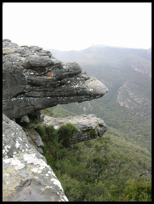
Today at Reeds Lookout the sky was almost clear, panoramic views for miles to the south, and chaos in the car-park with cars, buses and camper-vans packed side-by-side, not helped by the idiots who had parked on both sides of the access road leading in. I’d hate to be here in the summer — it must become almost impassable. The Balconies looked just like the postcards, against a grey sky rather than blue, and the track out onto them is closed off, no more standing in the jaws for a photo for the friends — either too much erosion or too many tourists were plummeting into the forest below…
Eventually we managed to extricate the car and get out onto the road before heading off for McKenzie falls…
Spelling seems to be a matter of opinion around here; possible variations have been Reed and Reid’s lookout, Zumstein and Zumsteins, and McKenzie and MacKenzie falls. Most of these seem to have optional apostrophes, depending on which brochure, map or road sign you happen to be looking at at the time. A guy in the kiosk at McKenzie falls claimed that it was because of the confusion between the National Parks and the local authorities, but on the wall behind him were two hand-written signs, in the same hand writing, offering both spellings of McKenzie!
McKenzie falls is one of the more popular tourist destinations and it shows. Large car parks, already full, with people spilling over into other roads and parking in driveways. There’s a kiosk and ice-cream stand, picnic tables and toilets. One family arrived with their dogs in tow, despite all of the Grampians being a National Park, where pets are forbidden — they were persuaded to put the dogs back into the car for the duration of their stay. Even the walking tracks have had to be concreted in order to minimise the erosion from the tramping of thousands of visitors…
I wonder how much longer the park can be free access, or accessible to private cars, there surely must come a time when the vehicle traffic makes it necessary to put restrictions on getting there — maybe an hourly shuttle bus around the sights is needed…
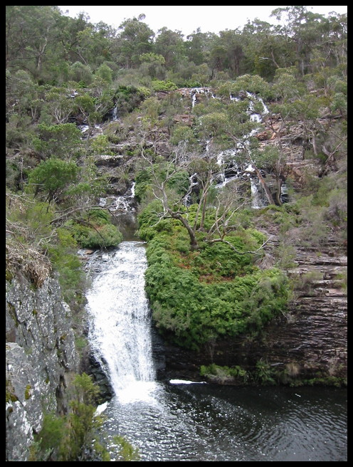
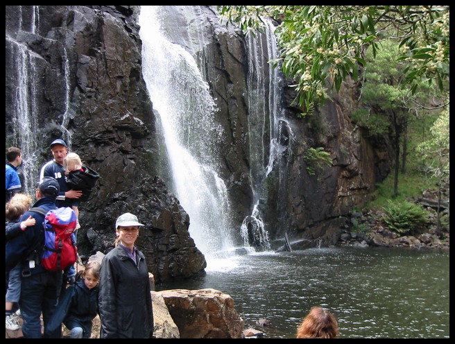
Since most of the other people were heading directly from the car-park to McKenzie falls, we decided to turn left and visit Broken falls, smaller but nearer. A good decision, when we got there we had the lookout to ourselves.
Off along the main path to the main falls, we could tell we were on the right track by the sheer number of people — not that there’s any chance of getting lost on a concrete path through the bush! The last few hundred metres are down a very steep, very narrow staircase, there’s only room for one person at a time, so people heading in opposite directions have to stop on the landings to pass. Down at the base of the falls it was crowded, 30 or more people walking around, clambering over the rocks, or just sitting drinking coffees and smoking. These last group seemed unaware of the need to not litter, and were quite happy to drop plastic cups and cigarette butts anywhere they happened to be — I grabbed about three cups on the walk back to the kiosk.
Who should we meet on the climb back up than Mr Noisy from — only this time he was sitting very quietly on a bench, looking quite red in the face, and not saying a word.
With impeccable timing we got back to the car just as the rain started again, and headed off past Zumstein (or Zumsteins or Zumstein’s) to Mt Zero and Hollow Mountain. One of the postcards that I picked up on Friday has a picture of three kangaroos on a grassy paddock and is labelled “Zumsteins” — presumably that is the name of the area, but Jo and I were laughing all weekend at the thought of overseas tourists seeing a photo of three furry animals and assuming that these were named “Zumsteins.” All afternoon we kept pointing to the Zumsteins in the paddocks.
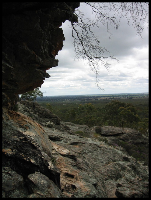
At least we were now into a less popular area of the park, only a few vehicles passed us on the roads. Just before the Mt. Zero car-park a trio of emus wandered across the road in front of the park, adding to the feeling of remoteness.
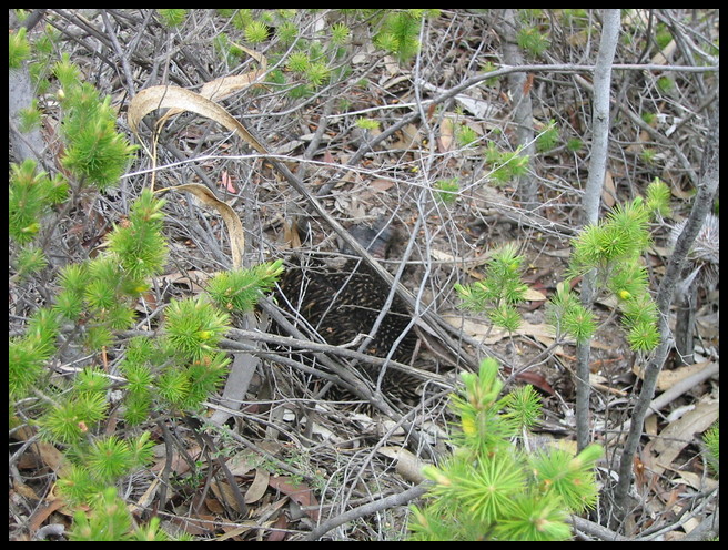
There are two walks marked, the first is past a disused quarry and on to one of the Koori cave painting areas that is open to the public. No pictures of the cave paintings — a vague feeling that maybe the owners might not like it, combined with the ugliness of the steel cage protecting the rock from the visitors deterred me. Reddish-brown child-sized ochre hand prints and emu tracks covered the overhanging roof. On the way out there a rustling in the bushes to the side of the path attracted our attention, carefully peering through the bush revealed this echidna desperately trying to hide itself from our prying eyes. We checked on the way back, but it had retreated to parts unknown.
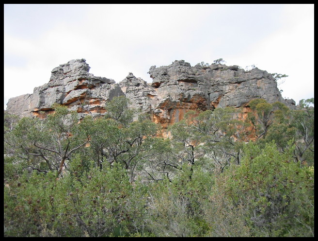
The major walk was then up to the top of Hollow Mountain, first through the bush and wild-flowers, then up and around the mountain. The path is clearly marked with small orange-red arrows painted on the rocks, but is a bit of a scramble in places — and definitely not for those afraid of heights!
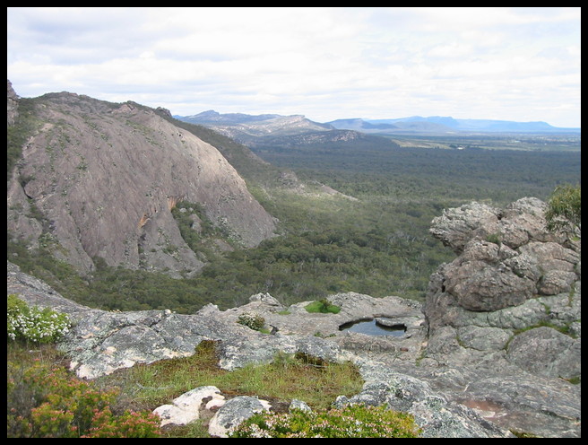
Spectacular views and icy winds greeted us once we reached the more open ground at the top, the higher slopes also had a group of ten or so rock climbers busily practising their technique on some of the overhangs. What amazed me more were the number of family groups climbing up their with very young children, a couple of babies in carry pouches and a few four to six year-olds!
After a while on the summit the chill wind and hunger started to outweigh the magnificent views, so it was time to head back. Scrambling back down we passed even more groups on their way up, then waded through the wild-flowers back to the car, cursing ourselves for not bringing any lunch!
Unfortunately it was time to start heading home, just as the weather seemed to be clearing up and we were getting into the spirit of the walking. Out to the highway with the intention of stopping in Ararat for a late lunch — last night’s visit to Stawall hadn’t inspired us to try there for lunch. Of course no highway trip in Australia would be complete without a sighting of one of the “Big things,” so as we passed through Dadswell Bridge we had to laugh at the giant concrete ugliness of a three-storey Koala that leers down at passing traffic and attempts to attract passing tourists.
Lunch was a magnificent stroke of luck. We parked at random in the main street of Ararat, then looked across the road to see “Café Kerry” beckoning. Nearly empty, and just starting to pack up for the day, but Kerry had a magnificent home-made beef, vegetable and red-wine pie, and equally delicious sausage roll/meat-loaf to serve us.
From Ararat onwards it was just a case of driving back down the highway to Melbourne, the only excitement being the speeding South Australian motorists who seemed determined to run us off the road from behind. We nearly suffered the embarrassing fate of running out of petrol between Ballarat and Melbourne, partially due to not really knowing how much fuel Jo’s car uses, and mostly due to the idiot road signs that direct you off the freeway into small towns for fuel — and don’t point out that some of these petrol stations shut at sundown, and some have shut months ago! Eventually we ended up back on the freeway, heading back towards Ballarat, just to get enough fuel to get us home! The car’s handbook isn’t very helpful either, with the message “when the low-fuel light flashes, you are about to run out” — we later calculate that there was 6 litres left and we could probably have driven all the way to Melbourne with the stupid light flashing at us!
